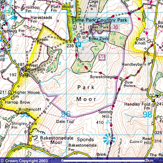
Lyme Park
Click on map to enlarge. However, please note because of scale limitations not all of the places mentioned are to be found on this map.
© Crown Copyright 2003
www.ordnancesurvey.co.uk/getamap
Image produced from Ordnance Survey's Get-a-map service.
Image reproduced with permission of Ordnance Survey and
Ordnance Survey of Northern Ireland.
Although the weather forecast was for rain, the sun was trying to break through the clouds as we put on our boots and waterproofs before obtaining a very helpful map of the estate from the National Trust Information Centre. Then we were off.
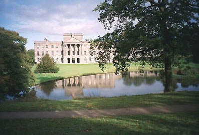
Leaving the car park we skirted the house, and its enclosed garden, anti-clockwise. It looked beautiful and we were so taken with it that we completely missed the turn to the south that went through an avenue of lime trees. However, within 20 or 30 yards I realised we were on the wrong path and backtracked to the lime tree avenue, which we followed up hill. Suddenly Anne said, "look" and just to our left, having a late breakfast, were a pair of deer. I did try to get a photograph of them but they had heard us and vanished before I could get a suitable "shot".
Looking back towards Lyme Park House from just inside Knightslow Wood.
We continued up hill with Anne realising that her lack of walks in recent weeks was having a detrimental impact on her ability to ascend the hillside. However, one of the pluses of this particular walk was that most of the hill climbing was at the start so the hard bits would soon be over.
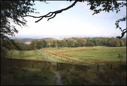
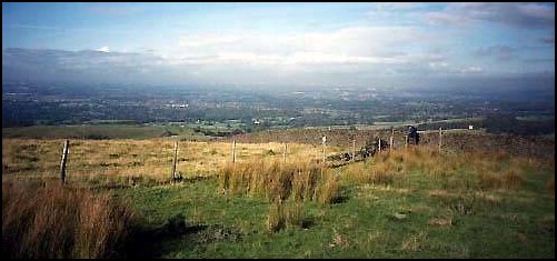
Open moorland. The white building to the right is the farm at Bowstonegate.
We left the lime trees and had wonderful views back to the house with the Manchester conurbation beyond and to our right and left more deer could be seen. We then entered Knightslow Wood before reaching open moorland and further walking up hill brought us to Bowstonegate and its namesake farm at just over 1000ft above sea level.
The next phase of the walk was much easier. A wide track on top of the moorland ridge took us south and after about a third of a mile we turned right (west) and followed a less well defined track that hugged the wall on our right. Looking over the wall we had wonderful views back towards Bowstonegate Farm and to its left across the moor back to Lyme Park.
The early part of the track was a bit muddy but did not cause us any difficulties and by the time we reached Dale Top, about two thirds of a mile further on, the track was much better. At this point I should have veered left, away from the wall, by about 30 degrees but instead we merrily sauntered down the hill to a farm at the bottom where I expected to be greeted by a "right of way" sign. But the only sign we saw said "Private" and I then realised my error.
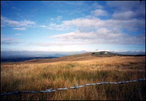
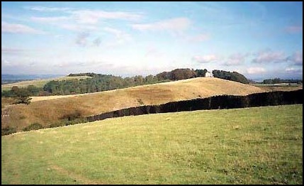
Open moorland near Dale Top with Manchester in the distance.
The "right of way" had been moved since the walk book had been published. But it was no great concern; we just turned left down the track called Moorside Lane that took us away from the farm towards a village called Pott Shrigley.
Isn’t Pott Shrigley a wonderful name? Makes me think of potted shrimps. I wonder how it got this name! However, it’s not the only strangely named place around here. A couple of miles south is Ginclough, which is near a place called Rainow and further south, near the Cat and Fiddle Pass, is a place called Bottom-of-the-Oven. I suppose if you look at any map in detail you will find strange named places, but there does seem a large number in this area.
Now it was down hill, over a stream and up the bank on the other side and soon we had some good views of a hillside called Cluse Hay. It looked very impressive with the sun shining on the little white building on its top. I would have liked to have gone up it, but there was a deep steep valley between it and us so we continued north west and then west to another lane, shown on the map as Shrigley Road
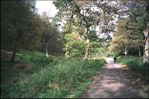
Walking through Hase Bank Wood.
On reaching the Shrigley Road we turned right and immediately right again, down a very narrow lane, and in a 100 yards or so turned right, yet again, and through West Parkgate, which, as the name indicates, is the west entrance back into Lyme Park. Once back in the grounds we were confronted by beautiful mixed woodland – Hase Bank Wood. A wide path took us uphill through the trees for about half a mile until we reached open parkland and from here we followed an obvious estate road back to the house and our car.
Although the walk was only 5 miles in length it was very interesting and with such diverse scenery I would certainly enjoy doing a variation of it again. And what about the forecast rain? It came five minutes after we had left Lyme Park and it was torrential.