Through Dentdale
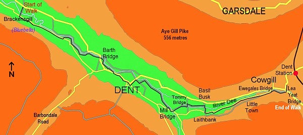
Although we had not originally intended to walk so far Anne wanted to see the bluebells that were growing on the south slopes of the dale. Although in leafy Warwickshire this year’s displays had vanished some weeks ago we were told they were still flowering in this area.
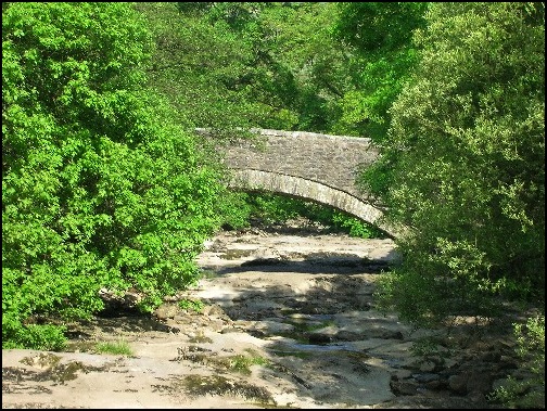
A farm track from our starting point at Grid Reference SD 668696 lead us downhill along the Dales Way to Brackensgill Bridge and over the River Dee to a lane where we turned left.
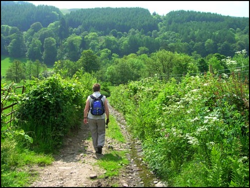
Anne, walking down the farm track to Brackensgill Bridge.
When we left Cowgill the weather had been cloudy but half an hour later the sun was shining and it was becoming very hot and I was soon regretting wearing trousers rather than shorts. Fortunately for Anne she was able to zip off her trouser legs.
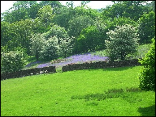
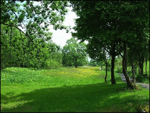
Bluebells on the hillside above Brackensgill.
On our right, as we walked along the lane with the river on our left, the bluebells. Although they were up the hillside we had good views of them as they spilled out of the woods onto the meadowland below.
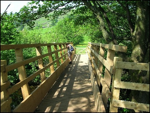
A view of the Dales Way to the east of Brackensgill.
About a mile along the lane the Dales Way turns off to the left and soon we were walking upstream along the south bank of the river. This was very easy and pleasant walking with wonderful views of the dale all around us.
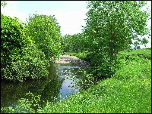
The River Dee near Brackensgill.
The next significant point was crossing the road near Barth Bridge before we continued along the river bank until we met the main road into Dent. Here we left the Dales Way which followed the river to the north of the Dent and followed the road into the village.
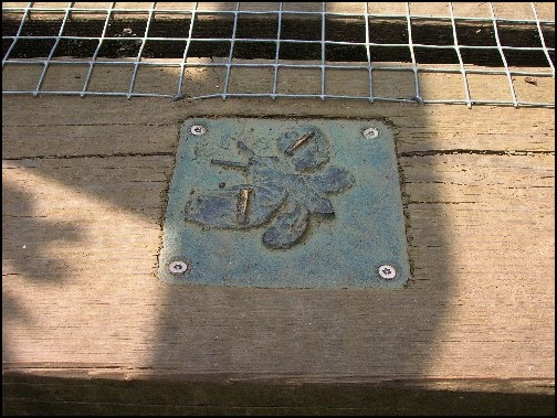
On many stiles on the path to the west of Dent a number of plaques, similar to the one above, were seen. However, although we presumed they were some kind of nature trail or similar, during our stay in Dentdale we did not find out the origin. Therefore many thanks to Bill & Lisa Randles who emailed me this information.
On your website..... you mention a series of metal signs. Well, if you really want to know more about them I would purchase The Dales Way guide published by Cicerone. The author is Terry Marsh. Look at page seventy five for a detailed description of their origin, under the heading Network of Gates.
These gunmetal plaques were created by local children from Dent Primary School. An Artist from Leeds was also commissioned to work on them. The plaques are intended to be more thought provoking than informative. The images were of topics known to the locals. Apparently there are twenty two in total, spread throughout the trail.
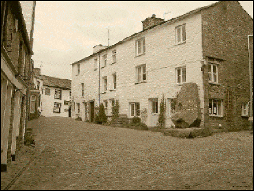
The village of Dent.
Dent is a lovely place. It’s steeped in history and is noted for its knitters (The Terrible knitters of Dent), cobbled streets, and being the birthplace of Adam Sedgwick who discovered the Dent Fault and was President of the Geology Society of London. Details of these subjects and more are to be found in the Dent Village Heritage Centre which is well worth a visit.
The large rock commemorates Adam Sedgwick, the village's famous son, and the Sun Inn is the building at the top of the road..
The village also has two public houses, The Sun and The George and Dragon, and they were open so I allowed Anne to drag me into the George and Dragon to enjoy a glass of the local beer which is brewed in Dentdale.
Break over we initially followed the main road out of the village towards Cowgill but on reaching the bridge over the river we turned right and rejoined the Dales Way. Although the “Way” soon left the river it soon turned north to rejoin water a little further upstream.
The bridge over the River Dee just outside Dent.
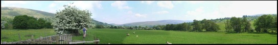
View looking east along Dentdale. Taken just east of Dent village.
There were certainly no navigation problems along this part of the route. We just kept to the south side of the river, past some stepping stones until where the river was met by a tributary the water vanished. We were not surprised at this. There had been very little rain for some time and in Limestone country it is not unusual for rivers to vanish along subterranean channels and reappear further downstream.

Where's the water gone! A dried up tributary of the River Dee.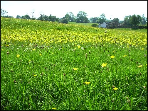
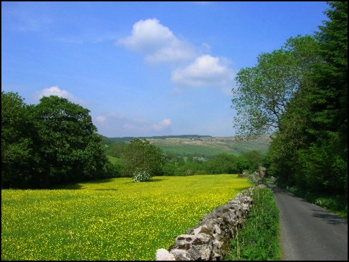
Glorious meadows, very much a feature of this walk.
Still on the Dales Way we followed the tributary south east, with the water playing “now you see us now you don’t” as it vanished and reappeared again until we reached the road that goes east to west to the south of the river at Mill Bridge(Grid Ref. SD 721861). Having crossed the bridge we turned left over a stile and went uphill, through a field of cows. There were wonderful views at the top of the hill and I would have liked to have taken more photographs but Anne was nervous about being in the vicinity of so many cows and quickly dragged me downhill back to the river away from the animals.
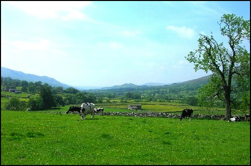
Cows and the view eastwards along Dentdale.
Here we turned right and in 100 yards, maybe less, we reached Tommy Bridge. One of the joys of this area are the names given to certain bridges and other landmarks. I’m still wondering who Tommy was and why a bridge was named after him. I would add that within a mile or so from Tommy Bridge there is also a place called Basil Busk and a Nelly’s Bridge
.
Tommy Bridge
So it was over Tommy Bridge and then we continued to follow the Dee upstream on its north bank until we reached the next footbridge and crossed over back to the southern bank before continuing uphill past a big drop on the right called Lenny’s Leap. (Don’t ask) until the lane was reached again near Laithbank, where we missed a turning.
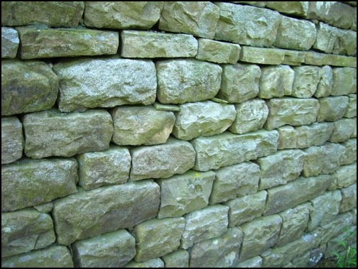
Limestone wall seen between Laithbank and Little Town.
To use this, or any other picture, as your Desktop "Wallpaper" place mouse over picture, right click and then left click over Set as Background.
Once on the lane having turned left (east) we should have taken a path to the right to continue along the Dales Way, but maybe we were still thinking about Lenny and missed the turn. But we were not too bothered as we had done that part of the Dales Way before and Anne was very happy to meander along the lane exploring the hedgerow vegetation.
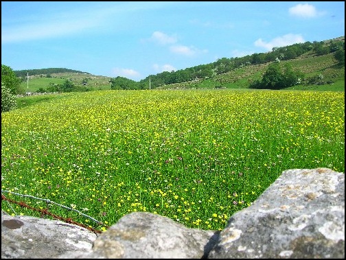
Wild flower meadows near Little Town.
About half a mile along this lane, on the right hand side, on the lower slopes of Whernside, is an area called Little Town which has, on three sides, conifer woodland. The Dales Way passes through this clearing from one part of the woodland to the other just below a large house which has commanding views over this part of Dentdale. The clearing also contains a few alpacas. Now unlike llamas, alpacas are supposed to be quite docile but I was told later that evening that some walkers were crossing the clearing and one of them decided to take a photograph of the alpacas. Now I don’t know if it was late in the day or if the shade from the trees caused the camera’s flash to “go off”, but flash it did. This upset the animals and I understand that when they are upset they can get very angry. The result was the walkers having to make a very swift exit over a stile into the woodland. I was glad we missed that turn.
The lane near Little Town.
Soon the lane was rejoined by the Dales Way and shortly afterwards we reached Ewegales Bridge where the lane meets the main road going through the Dale. However, rather than cross the bridge over the Dee and join the main road, we turned right and followed the river the short distance to the Lea Yeat Bridge in Cowgill. From here it was a short walk to where we were staying.
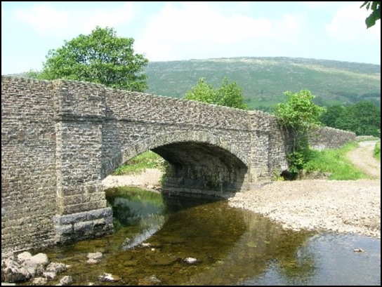
Lea Yeat Bridge in Cowgill
Although we did not visit it on this occasion, to the east, half a mile along the road, is the Sportsman’s Public House, which, besides being on the Dales Way, is the only establishment in this part of the dale to sell food and drink.
The map used for this excursion was the OS Explorer OL2 Yorkshire Dales- Southern and Western Areas and the total distance walked was about 7.5 miles.