The 4th Peak District Challenge
Here is my report for No. 2 and my report for No. 3. So along with Larry, we decided to have a go at number 4.
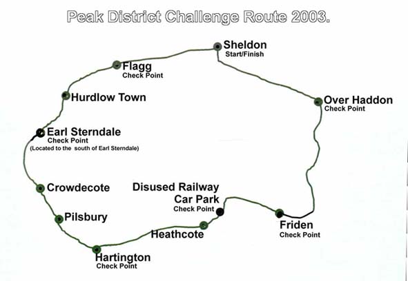
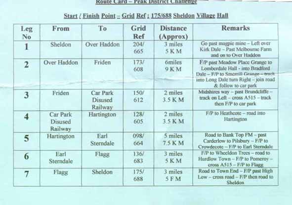
Sketch map of route and Route Card (it got a bit wet)
During the days leading up to the walk there had been low pressure over the British Isles and rain was coming in from the southwest and, as per usual, the weather forecasters' predictions were somewhat "uncertain". We had promises of "intermittent rain", "showers", and "moderate rain". On the day before the walk the forecast said there was a possibility of thunder late in the afternoon on the 19th. However, I don’t think anyone was prepared for the clothes drenching, boot soaking, lake making, cloudburst that hit the walkers before most of them were even half way around the route.
Besides Mick and Larry, Greg, my eldest son, and his brother-in-law John had also decided to take part. Although Greg has done both the White Peak Walk and Chatsworth Challenge it had been some years since he had done a long walk; he prefers shorter ones up mountains. John, I understand, had not done a long walk before so was unsure about how many of the 24 miles he would complete.
I dislike doing challenge walks in trousers – can get very sticky if the day is warm - and, like Mick, I prefer shorts. So although the day did not promise to be a heatwave we both considered that if we had the odd shower later on in the day we would be happier having a leg wetting than having to walk along with trousers, plus overtrousers on. Added to this I have size 12 feet and getting overtrousers over them can be difficult.
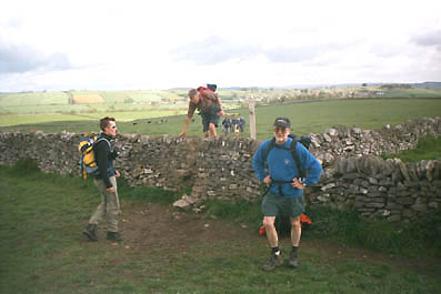
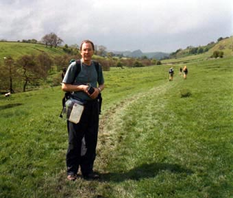
It’s 9 o’clock and we are on our way. The sun is out, I feel fit,and my boots feel comfortable. The only problem I have is getting over some of the stiles that are already wet and progressively getting muddier, slippier and more treacherous after the walkers in front of me have negotiated them. I have noticed in recent years many of the old wooden and limestone stiles have been replaced by ones that are much less of a "challenge" and more easily negotiated by older walkers. I really appreciate "meeting" these.
The walk to the first check point at Over Haddon is reached in about 50 minutes. The sun is still out and I’m happy with progress. I had walked up the slope out of Kirk Dale with no difficulty, although, on the O.S. Map of the White Peak Area, it looked to be one of the steepest ascents of the day. So all was well. It was even getting quite warm, so like the rest of our little group, some top layers are removed and deposited in rucksacks.
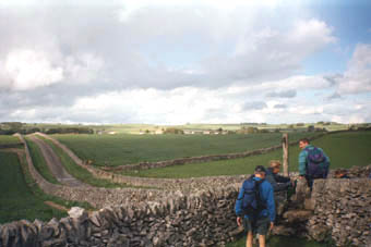
It’s now down into Lathkill Dale. However, unlike previous PDC walks I have done, this time, instead of following the dale up or down stream we go straight across it and up theother side. This is a bit of a "pull", but the zig-zag path makes the ascent considerably easier than a direct route.
August 2009 - Have been informed by Chris Judd that the patterns on the dale side slopes are a result of "soil creep". This happens in lots of steep sided dales, particularly when the soil is not very deep, therefore not a depth of root to bind the soil together. Thanks for that Chris.
Just as we had left the dale the rain hit us. I can’t remember having been in such a torrential downpour. Seems as if the great weatherman in the sky took a dislike to this part of the Peak District, or maybe he felt we all needed a good hose down. Certainly hosing us down could not have made us any wetter. And then the rain turned to hail.
Mick decided to put his overtrousers over his shorts but my shorts were so wet I thought this might have caused a greater problem in the "pants department". So I stood there with others "enjoying" the views until the precipitation slowed down to something slightly less than a cloudburst and then we strolled on.
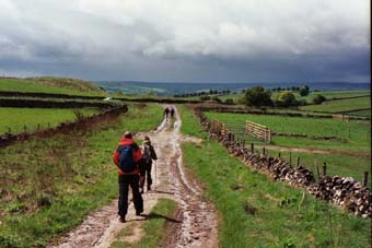
On reaching the road we were amazed at the amount of water coming down it. Clods of soil were being swept away from the verges and we were walking almost in the middle of the road, as walking on the edges would have been the equivalent of wading in a considerable torrent. Then we reached the check point at Friden – 9 miles gone – and the rain stopped.
By the time Greg, John and I reached this check point all the biscuits had gone, but there was still plenty of water to drink which, following the weather we had just experienced, seemed superfluous. However, to prevent dehydration I had a drink. Mick was taking his overtrousers off - I gather they were going up and down, on and off all day - and Larry was eating. While Greg and John had some food I partook of a very nice hot cross bun with cheese in. Why do we call them hot cross buns even when they are cold? Answers please to fairweather@brilwalks.com. However, by the time us stragglers had sorted ourselves out Mick and Larry were vanishing northwards along the High Peak Trail.
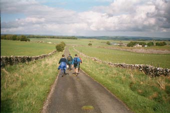
It is one mile, give or take a metre or two, from the Friden Check Point to the point on the High Peak Trail where you turn off left towards the next check point, which is the car park at the disused railway station located to the east
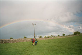
We left the car park and walked towards Heathcote before taking the lane that would take us to Hartington. However, before reaching Hartington and the 13 mile check point we got wet again. Very wet. Which was annoying, as by now I had dried out a little and was now only very damp. Now I’m not sure if this cloud burst was worse than the first, but if it wasn’t it was not very far behind in ferocity. We tried to shelter under some trees by a pond called Heathcote Mere. I am sure the level of it increased while we admired the size of bulrushes in the mere. Certainly lakes were beginning to appear on the road and then thunder sounded in the distance. Greg advised us to get out from under the trees, as it is not a recommended place to shelter if there is the likelihood of lightning. So we continued on our damp journey, with new streams rushing alongside us, to Hartington.
One of the first things Greg saw in Hartington were ducks sheltering under cars to get out of the rain. Although rain storms are often referred to as "nice weather for ducks" it seems that even ducks can have too much of a good thing.
Earlier Greg had been able to contact his wife, Jen, by mobile phone and arranged to meet her in Hartington. We were drenched. It seemed that Mick and Larry were well ahead, We were almost last and feeling very dejected and certainly not finding the walk much fun, so at about 1.45 p.m. we called it a day. I felt very sad about this. I hate not completing walks. However, I felt a little better about it when the lady on the check point said, "I don’t blame you". So I got in Jen’s car, with Greg and John, and was taken back to Sheldon to wait for Mick and Larry.
Now for Larry’s view of the next part of the walk – (my comments are the red italics in brackets).
Unlike Barry (A.K.A. Fairweather), Mick, who is the spitting image of ‘Uncle Albert’ the sea dog from "Only Fools and Horses" and I love extremes of weather. The thunder and lightning, rain and hail plus Barry’s stories about Vaseline Val and the promise of a lovely home made Steak Pie with new potatoes and vegetables all added to our enjoyment of the day. So much so that at one point we decided that, rather than stick to the quickest route, we would go the long way (for long read wrong) and increase the walk by a couple more miles. (Like so many walkers they never get lost - just take scenic detours!!) Hardly noticing the rain and hail we skipped our way along to Hartington where I purchased some White Stilton and Apricot Cheese to take back home (Larry enjoys his food). We then left Hartington and took the track to Bank Top Farm. I had stayed "Bed and Breakfast" here in the past and was tempted to pop in and ask if there was any chance of a takeaway. It was one of the best B&B I had ever stayed in.
back to the village hall and dry out a bit. He was obviously tempted by the thought of Vaseline Val and that lovely Steak Pie. (It’s not true about the Steak Pie)
Well that was Barry’s day almost over, apart from ringing me about every 10 minutes to ask whether it was raining where we were and to find out how long it would be before we reached Sheldon as he was waiting for us before he had his Steak Pie. (I was also available to give them long range navigation assistance which seemed to be becoming more necessary – If I had known they were behind me at Hartington, and getting lost so easily, I’d have waited and continued the walk with them – honest)
Mick and Larry’s time was 8 hours and 48 minutes.
If you want to follow the route in more detail, or walk all or part of it, you will need the O.S. Outdoor Leisure Map No. 24, which covers the White Peak Area.
If you want to find out about Vaseline Val and how to prevent blisters you will have to look at the 2nd Peak District Challenge.